State Of Emergency: Hurricane Erin Batters NJ Shore With 14-Foot Waves, Peak Flooding Tonight State Of Emergency: Hurricane Erin Batters NJ Shore With 14-Foot Waves, Peak Flooding Tonight State Of Emergency: Hurricane Erin Batters NJ Shore With 14-Foot Waves, Peak Flooding Tonight
State Of Emergency: Hurricane Erin Batters NJ Shore With 14-Foot Waves, Peak Flooding Tonight New Jersey Gov. Phil Murphy has declared a State of Emergency ahead of Hurricane Erin, warning residents about dangerous conditions along the Shore Thursday, Aug. 21. The State of Emergency went into effect at 2 p.m. "in preparation for Hurricane Erin,” Murphy said. “Life-threatening rip currents will be present at all ocean beaches across the state. Absolutely no one should be in the water today or tomorrow.” As of 2 p.m., Hurricane Erin was moving farther away from the Mid-Atlantic coast, according to the National Weather Service in Mount Holly. Wind gusts of 35 to 45 mph were reported al…
Swimming Banned At These NJ Beaches As Hurricane Erin Approaches Swimming Banned At These NJ Beaches As Hurricane Erin Approaches Swimming Banned At These NJ Beaches As Hurricane Erin Approaches
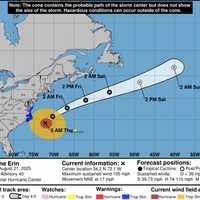
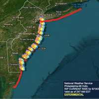
Swimming Banned At These NJ Beaches As Hurricane Erin Approaches Hurricane Erin is churning up the Atlantic, prompting dangerous surf conditions and widespread swimming restrictions at New Jersey beaches this week. Hurricane Erin's projected path. National Weather Service The National Weather Service said Tuesday, Aug. 19, that breaking waves will significantly increase along the Jersey Shore through Thursday, with life-threatening rip currents and swells of 6 to 11 feet expected.  “Life threatening rip currents are likely. The surf zone is dangerous for all levels of swimmers. Stay out of the water,” the agency warned. A High Rip Current R…
Small Tornado Touches Down Near US Naval Academy During Storms: Weather Service Small Tornado Touches Down Near US Naval Academy During Storms: Weather Service Small Tornado Touches Down Near US Naval Academy During Storms: Weather Service
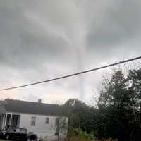
Small Tornado Touches Down Near US Naval Academy During Storms: Weather Service The National Weather Service confirmed that a small tornado was spotted in Maryland during the peak of Thursday's storms.  Forecasters say that a waterspout formed over Spa Creek — near the US Naval Academy — and what registered as an EF-0 tornado briefly touched down in Eastport on July 31. According to the National Weather Service, the tornado was reported shortly after 2:45 p.m. on Thursday with peak winds estimated at 65 mph. Its path was just 0.1 miles long, and it had a max width of 25 yards. A combination of videos and photographic evidence have confirmed that a waterspout b…
Montgomery County In Flood Watch Zone: Up To 5 Inches Of Rain Expected Montgomery County In Flood Watch Zone: Up To 5 Inches Of Rain Expected Montgomery County In Flood Watch Zone: Up To 5 Inches Of Rain Expected
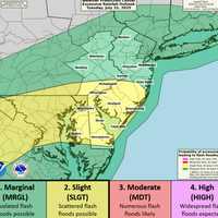
Montgomery County In Flood Watch Zone: Up To 5 Inches Of Rain Expected A powerful round of thunderstorms is expected to hit New Jersey and eastern Pennsylvania beginning Monday afternoon, July 14, with the National Weather Service warning of flash flooding, possible power outages, and dangerous driving conditions. The NWS in Mount Holly issued a Flood Watch that remains in effect through 2 a.m. Tuesday for large parts of the region. Some areas could see rainfall rates exceeding two inches per hour, with total accumulation of up to five inches in spots. Another round of storms is likely Tuesday afternoon, adding to the risk. According to forecasters, the greate…
Tornado Touched Down In Pennsylvania: NWS Survey Confirms Tornado Touched Down In Pennsylvania: NWS Survey Confirms Tornado Touched Down In Pennsylvania: NWS Survey Confirms
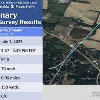
Tornado Touched Down In Pennsylvania: NWS Survey Confirms A weak tornado briefly touched down in Berks County, damaging trees along a nearly mile-long path, the National Weather Service confirmed in a statement issued Wednesday, July 2. The EF-0 twister struck Weavertown in Amity Township around 4:47 p.m. on Tuesday, July 1, according to the NWS Mount Holly office. Peak winds were estimated at 70 mph. "Several trees had large limbs broken or snapped off, some of which were twisted," the agency wrote. One tree was completely uprooted, and tree damage continued along Weavertown Lane, crossing Old Swede Road. The tornado’s path ended at Boyertown Pik…
28K+ Without Power As Extreme Heat Wave Scorches Pennsylvania 28K+ Without Power As Extreme Heat Wave Scorches Pennsylvania 28K+ Without Power As Extreme Heat Wave Scorches Pennsylvania
28K+ Without Power As Extreme Heat Wave Scorches Pennsylvania Blistering temperatures and busted substations are pushing Pennsylvania's electric grid to the brink. Over 28,000 customers across the state were left in the dark Monday, June 23, as oppressive heat surged into the region, compounding recovery efforts from Thursday night's severe storms, utility companies said. Littlestown Blackout: Substation Failure Leaves 65% Without Power In Adams County, more than 2,500 First Energy customers are without power after a “major equipment failure” at a Met-Ed substation, according to a statement from Adams Electric Cooperative, Inc. That failure also disru…
Tornado, Flood, Hail Threat As ‘Extreme Thunderstorms’ Slam Region Tornado, Flood, Hail Threat As ‘Extreme Thunderstorms’ Slam Region Tornado, Flood, Hail Threat As ‘Extreme Thunderstorms’ Slam Region
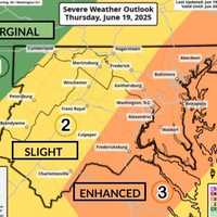
Tornado, Flood, Hail Threat As ‘Extreme Thunderstorms’ Slam Region Wild winds, large hail, floods, and possible tornadoes may roll through the region overnight, forecasters are warning. The National Weather Service issued a "Level 3 High Impact Severe Weather Threat" on Thursday, June 19, as storms begin hitting the area. 12:24pm CDT #SPC_MD 1364 , #njwx #pawx #dewx #mdwx #vawx #dcwx #wvwx, https://t.co/Y7ej7h7rco pic.twitter.com/q6cAaizrQk — NWS Storm Prediction Center (@NWSSPC) June 19, 2025 Officials also issued severe thunderstorm and flood warnings for parts of Virginia and western Maryland. "Severe Thunderstorm Watch in effect for a large porti…
Heat Advisory Issued In NJ/PA: Here’s Where Temps Will Feel Like 100° Heat Advisory Issued In NJ/PA: Here’s Where Temps Will Feel Like 100° Heat Advisory Issued In NJ/PA: Here’s Where Temps Will Feel Like 100°
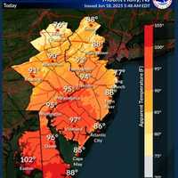
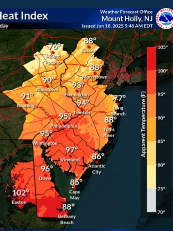
Heat Advisory Issued In NJ/PA: Here’s Where Temps Will Feel Like 100° The National Weather Service has issued a Heat Advisory for parts of New Jersey and Pennsylvania, with “heat index values up to 99 expected” and the potential for it to feel even hotter in the sun. The advisory is in effect from 11 a.m. Wednesday, June 18, through 8 p.m. Thursday, June 19, as dangerously high temperatures and humidity grip the region. ⚠️ Heat Advisory Areas Include: Camden County Gloucester County Northwestern Burlington County Philadelphia County Delaware County “Hot temperatures and high humidity may cause heat illnesses,” officials said in the advisory issued at 2:22 a…
Tornado And Earthquake Rock Pennsylvania Days Apart; Here's Where Tornado And Earthquake Rock Pennsylvania Days Apart; Here's Where Tornado And Earthquake Rock Pennsylvania Days Apart; Here's Where
Tornado And Earthquake Rock Pennsylvania Days Apart; Here's Where A twister and a tremor shook separate corners of Pennsylvania just days apart, officials say. Surveyors with the National Weather Service confirmed an EF-0 tornado touched down in Clarion County on Tuesday, June 4, bringing 75 mph winds and damaging storms. The tornado carved its path along Brush Run Road, though officials say the exact track has not yet been determined. Crews also examined nearby damage along Haugh Hollow Road and Route 322, but determined that was caused by a downburst or straight-line winds peaking at 80 mph — not tornadic activity. This marks the first confirmed tornad…
Winds Up To 70 MPH, Hail, Lightning Expected In NJ, PA: Here's The Timing Winds Up To 70 MPH, Hail, Lightning Expected In NJ, PA: Here's The Timing Winds Up To 70 MPH, Hail, Lightning Expected In NJ, PA: Here's The Timing
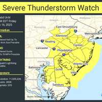
Winds Up To 70 MPH, Hail, Lightning Expected In NJ, PA: Here's The Timing Flash flooding is slamming parts of New Jersey and southeastern Pennsylvania Friday, May 16, with more severe weather possible on Saturday, forecasters say. At 11:32 a.m., the National Weather Service in Mount Holly issued a Flash Flood Warning after Doppler radar showed rainfall rates of 2 to 4 inches per hour. Some areas have already recorded an inch of rain. “Flash flooding caused by thunderstorms,” the NWS said. “Flash flooding is ongoing or expected to begin shortly.” The warning is in effect until 3:30 p.m. for the following counties: In New Jersey: Southwestern Mercer, Northwester…
Videos Show Tornado Confirmed In PA, National Weather Service Says Videos Show Tornado Confirmed In PA, National Weather Service Says Videos Show Tornado Confirmed In PA, National Weather Service Says
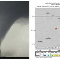
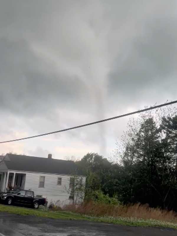
Videos Show Tornado Confirmed In PA, National Weather Service Says A tornado touched down near Bangor in Northampton County on Tuesday afternoon, May 6, the National Weather Service in Mount Holly confirmed. “We have confirmed a tornado occurred this afternoon near Bangor in Northampton County, PA,” the agency said. “Additional details will follow later this week after a storm damage assessment is completed.” Multiple videos of the twister surfaced before it was confirmed. LIKELY TORNADO ON THE GROUND…Moving towards Bangor, PA. Shot from Bushkill Township, PA. #PAwx @NWS_MountHolly pic.twitter.com/mr1MVtBYAA — joseph martucci (@jtooch07) May 6, 2025 …
Ping Pong-Sized Hail, 70 MPH Winds Threaten North Jersey, Lehigh Valley Ping Pong-Sized Hail, 70 MPH Winds Threaten North Jersey, Lehigh Valley Ping Pong-Sized Hail, 70 MPH Winds Threaten North Jersey, Lehigh Valley
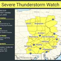
Ping Pong-Sized Hail, 70 MPH Winds Threaten North Jersey, Lehigh Valley A Severe Thunderstorm Watch is in effect until 8 p.m. Tuesday, May 6, for parts of New Jersey and Pennsylvania, the National Weather Service Storm Prediction Center said. Residents in Philadelphia, Trenton, Allentown, Reading, and across North and Central Jersey are impacted, the NWS said. “Isolated thunderstorms have developed over portions of the region,” the National Weather Service said in a Tuesday afternoon update. “The primary threat will be for hail and damaging winds across eastern PA and northern/central NJ.” Threats include: Scattered hail up to ping-pong ball size Wind gusts …